Saturday, April 10, 2010

The Wrap Up


April 8 - Haul Out Day

Our appointment to be hauled out was for 1pm. We motored to Spice Island Marine (about a quarter of mile from where we were anchored) and the crew at Spice Island had us hoisted out of the water in no time. The entire process went flawlessly. They then moved us with a highly maneuverable vehicle to a narrow spot between two other boats. That is now Lahaina Roads' home for the next six months. And for us there is no more rolling sensation. We are on the hard, as they say. Now it takes a long ladder to get on board. There is no more taking a quick dip in the water before dinner.

We took a quick trip to Grand Anse to go to the bank and to a store - it was an adventure. The buses here are similar to elsewhere in that they are vans. Here, though, there is a twist to the process. Each “bus” has an additional individual whose job it is to entice and recruit more riders. Some of them use pretty aggressive techniques to reel in additional riders. One, in fact, jumped out of his bus, ran over to me (about 100 feet), then grabbed me by the arm to get me to ride on his bus. I opted out since another bus had just pulled up right where I was standing. I suppose that this is the entrepreneurial spirit alive and well. The bottom line is better with each additional rider.

The following day was spent getting the boat ready for the hurricane season. We took down the headsail, mainsail and mizzen, along with the reefing lines and preventers. The outboard for the dinghy was thoroughly cleaned and stowed, as was the inflatable dinghy itself. These were not trivial tasks. The sails are huge, bulky and heavy. The dinghy and motor are heavy too and has to hoisted from the ground all the way up into the boat, rolled up and stowed. The 90 degree weather and 85% humidity made it all that much more work. By 4:30pm we were tired and ready for a shower. It was time to sit down and relax.

Sitting on the boat on the hard in the middle of a sea of other boats is a strange sensation. You see so many boats and masts and a number of people diligently working, cleaning things and putting gear away. It’s a solemn sort of a moment in which all these (expensive) adult toys are being neatly stowed away, hopefully to be played with, six months from now. Literally, millions of dollars in boats are busily being prepared (just in this marina).

Monday morning we leave for home. Our Caribbean adventure - Part I is wrapping up.

Friday, April 9, 2010

Union, Carriacou and Grenada


April 2 - Union Island

Union Island is the most southern of the Grenadines. We anchored in Clifton Harbor, the island’s main town. Clifton is one of the larger towns we visited (although still mostly all on one main street). The airport landing strip is a stone’s throw from the main street, so it was fun to watch the planes taking off and landing so close by.
The town is colorful and is not as run-down looking as so many of the other places we have seen. It has a cute central market area with fresh produce for sale. But let me comment on the cost of the produce - it is not cheap! Most of it comes from St. Vincent or elsewhere. For example, I bought six small tomatoes and a small papaya for $9.20! I asked an expat if there was a double standard for charging foreigners and she said no, that produce was just VERY expensive.

Being that it was Good Friday, the long weekend celebration had started. (It appears that all of these islands take their Easter holiday seriously. The drinking starts on Friday and continues through Monday.) A number of the local men were hanging out in front of bars drinking rum, listening to the music, talking and checking out the ladies that walked by. We had a feeling things were going to get loud in the evening.

The following morning we headed off to Carriacou, one of the three islands in the Grenada chain.

April 3 - Carriacou Island

In Carib, the word Carriacou means “island surrounded by reefs”. One look at the charts and you realize that they knew what they were talking about. We first entered in Hillsborough to clear customs and immigration. We were successful with clearing customs, but immigration was off to lunch. They must have eaten a lot, for they were gone the rest of the afternoon.

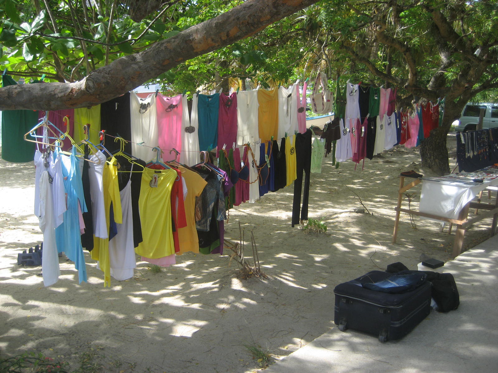
The town of Hillsborough runs mainly along one street paralleling the beach. An assortment of restaurants, bars and boutiques fill the main street’s beach side, while on the other side are some run-down buildings, grocery stores and fresh produce stands.

During our fruitless, long wait for immigration, we talked to a friendly taxi driver. A real nice fellow. I asked him how he could afford the impressive new Toyota diesel he drove. He said it was from a small business loan that the government offered. We talked about the U.S. invasion of Grenada back in the 80’s after Maurice Bishop, the communist leaning prime minister, was executed along a number of his cabinet. He said that in spite of Bishop’s acts of tyranny, he had made some good contributions by improving education and access to health care, but at the cost of civil liberties. Even today, he remains a popular person.

We gave up waiting for the immigration official and headed back to the boat, hoping to complete the check in, in Grenada. With Hillsborough being a wide open bay (the only one without a reef around it), we opted to move to the more sheltered bay of Tyrrel.

It was late afternoon by the time we anchored in Tyrrel. The bay wasn’t very interesting looking. A local came by the boat and sold us a dozen “mangrove oysters” and a fellow named Simon, in an old beat up row boat, offered to sell us bottles of Australian and Chilean wines. The prices were reasonable but we didn’t really need anything. He looked surprised when I told him no thanks - we still have plenty of wine.

April 4 - Carriacou to Grenada (Our final destination)

We pulled up anchor after breakfast. There was a light easterly breeze, so we decided first to motor. Along the starboard side of us was a tug boat towing a big barge and we could see by the way it was towing, there was a strong current at work. It was helping us move along briskly for a total of eight knots. Not bad.

Eventually, we hoisted the sails and had a leisurely sail to the coast of Grenada. As we approached the island from the north, it appeared steep, lush with vegetation and verdant, not unlike St. Vincent. But by the time we got near to the south in St. George, its capital, the land was flatter and dryer looking.

We anchored in the outer harbor and went ashore to find immigration. No luck. They were on holiday hours (apparently, Easter in these islands is a four-day holiday). We then decided to have a look at St. George. The inner part of the harbor was quite pleasant looking and is called the Carenage. From afar, it looks a bit like pictures of Portofino, Italy. But on closer inspection, the area had a more worn and rustic edge to it. Fort George, overlooks the entrance of the harbor. Around the waterfront area there are lots of old brick buildings - stores, warehouses and some government buildings. It would be a perfect place to have sidewalk cafes and restaurants, but none were in sight. Two cathedrals can be seen up the hill. When we walked to them, we noticed both were in ruins (perhaps damaged by hurricanes).

The following day we moved to the south of the island. Prickly Bay is where Spice Island Marine is and that‘s where Lahaina Roads will be hauled out and put on the hard. Prickly Bay is upscale, with huge, multi-million dollar homes lining the hills of bay. One end of the bay has a nice white sandy beach with palm trees. Part of it is owned by the exclusive Calabash Resort, a spendy looking place.

The following day we rented a car to circumnavigate the island and see some of the interior, which has a rainforest, rivers, lakes and waterfalls. Driving here is on the left - that’s always fun! The first place we went to was the Grand Etang Reserve. There was a small crater lake there, a visitors center and some shops. It was reported that Mona monkeys come by the visitors center but we never saw any.

Next, we drove to a spot where you can hiking to a series of waterfalls. We parked the car and proceeded by foot through a beautiful farming area that eventually led to a steep, wild and jungle-like path winding its way through the forest. After about a half hour we found the waterfall. We took a refreshing swim in the cool water and after a while headed back.

We then went to look for the nutmeg plant in the coastal town of Gouyave. Finding it was a bit of a challenge because the roads were poorly marked and the map we had was insufficient in detail. But after a few missteps we got on the right track and found it. The building was an old warehouse, dark and somber looking. A tour guide explained to us how a rusty and antiquated-looking machine cracked the shells open and then how workers separate the mace from the nutmeg and the final process of how the nut gets ground. Grenada is only one of two countries in the world (Indonesia being the other) that grow and export nutmeg and mace.

The factory had a small store that sold nutmeg products such as syrup, liquor and yes, wine! I didn’t buy any, already having been disappointed by an earlier purchase of ginger wine. I’m sticking to grape wine for now.

The rest of the island driving adventure was nice but by the end of the day we were glad to be back to the boat.

Friday, April 2, 2010

Bequia, Canouan and Tobago Cays


March 31 - Bequia to Canouan

First, something I forgot to elaborate on in my last blog posting. In fact, it was the first photo of a father (Hadu) and his young son at a fruit stand. We had such a nice chat about island life, how he’s worked as a fruit vendor in Bequia for fifteen years and much more. Then he commented that, for an American, I have a dark skin. So I told him my family history. Yet he was very light for a St. Vincent native. So I asked him the same thing. You are very light for a St. Vincent person. How come? He laughed hard. He said “Ah, but I’m black inside. You see, my mother is black and my father is from Portugal.” After he told me that, I told him about the American term for blacks who identify more with whites than blacks and are called “Oreos”. And that it referred to a cookie that was chocolate on the outside with a white cream inside. I told him that it was sort of the opposite of what he was. He simply loved it. He insisted that I write it down. I told him he could go buy Oreos right down the street at one of the small grocery stores in town! It was one of those memorable moments in a trip I’ll never forget.

We left Bequia late next morning and headed to Canouan, another one of the Grenadines. It was again a very comfortable beam reach of about fourteen miles. Once again when we got into the harbor in Charlestown Bay, there was evidence of a drought. The land looked parched and the shrubs were dusty looking.

Canouan is a small island. It is only a bit more than three miles long and half as wide. We went for a walk ashore and bought some local vegetables. On the way back, we stopped and had a drink at the Moorings Yacht Charter bar overlooking the bay before heading back to the boat for dinner.

Apparently, Canouan has nice beaches (and exclusive resorts). But unfortunately, the rest of the island is very trashy and with typical ramshackle housing with million dollar views. Not a place we wanted to spend another day.

April 1 - Canouan to Tobago Cays

We left Canouan after breakfast and headed for Tobago Cays. Being that it was only about four miles south, we were there quickly. The cays are a small group of tiny, uninhabited islands that are part of the national park system of the Grenadines.

We maneuvered through a narrow pass in between two of the small islands and found our way to a beautiful but very crowded anchorage near the fringes of a barrier reef that protects the anchorage from the Atlantic swells. The water was a beautiful emerald blue. The words idyllic and quintessential come to mind. We had not even anchored when we started to see turtles pop up for a breath of air.

After getting the boat anchored, we went snorkeling near one of the islands that is specifically reserved for turtles. We were in the water but a few minutes and already I could see five large turtles munching on grass at the water’s bottom. Every few minutes they’d come up for air and return to munching more grass. The turtles were haw bills. Our presence didn’t seem to bother them in the least.

Having had our fill of turtles. we swam out towards the reef’s edge. The snorkeling was outstanding. Lots of varieties of colorful fish and soft and hard coral. And it was all within a few feet from the top of the water. On the way back to the boat we stopped at other one of the small islands and walked around its white sandy beach with palm trees arching over into the water. Tobago Cays surely rates as one of the premier spots we had seen.

In the morning, after a leisurely breakfast, we headed off to Union Island, again only about four miles south.

Wednesday, March 31, 2010

Castries to Bequia


March 27 - Castries to Marigot Bay

From Castries, it was a short trip to Marigot Bay. The boat boys were out quite a ways from the harbor to assist us. We were looking for one of two guys - Michael or Nash. The one fellow who approached us identified himself as Nash. He took us to a mooring.

Marigot was a very narrow bay lined with palm trees to the edges and white sandy beaches. Like a movie set. Small resorts and restaurant/bars along the beach. Boats were in very tightly together. Uncomfortable so

Boat boys can be helpful but they also can be a pain. Too many of them were coming by asking us if we needed help, could they get us ice, groceries, take the garbage, etc. With some of them you could tell a sort of desperateness in their behavior - they really need the money.

It turned out that our boat boy, Nash, wasn’t who he said he was. Luckily, he wasn’t such a bad guy. To our credit, we knew to ask for a receipt for the mooring. But he never asked us for money. He told us that we needed to go to the office ashore to pay for the mooring. The way that pseudo-Nash made his money was to sell trinkets and carvings (made in Guatemala).

The following morning we left Marigot and again made a quick trip to the next anchorage of Sofriere, which was right under the peak of the Petit Piton. Pretty darned spectacular being anchored in the shadow of this beautiful, steep and craggy peak.

We went snorkeling around our the boat and it turned out to be excellent. What I found to be most unusual were a type of bushy, two to four feet long, corn-yellow palm frawns that were stuck on big underwater rocks. Hundreds of fish were swimming around. Quite a sight. Of the fish I saw, the only one I had not spotted before was a long, barracuda looking fish that had more of a dolphin-nose with small teeth. At first look I mistook it for a barracuda. But upon closer inspection, it was very different looking. They were inquisitive and not shy, keeping a close eye on me.

March 29 - St. Lucia to St. Vincent

Between St. Lucia and Bequia, our next intended anchorage, was St. Vincent. But we’d heard lots of negative comments on it regarding boat security and night time boardings. We had opted to bypass it until we talked to a French fellow in the anchorage who had just come from Cumberland Bay, St. Vincent. He had had a delightful stay there and had felt quite safe. So we decided to stop in St. Vincent on our way to Bequia.

When we finally left Sofriere we found a nice and steady easterly wind. After having some frustrations finding the right sail configuration for the wind and seas (and trying to mitigate the weather helm), we ended up having a smooth sail to St. Vincent. It turned out that the mizzen was causing a lot of the weather helm. After we took it down, the autopilot easily steered the boat.

The approach to St. Vincent from the north is quite spectacular. The first thing one sees is the Sofriere Volcano peak in a misty cloud with verdant vegetation that goes straight down to the ocean.

Once we got to our anchorage, Wallilabou, just as the book mentioned, boat boys in their row boats were out ready to help us find a mooring and help us tie our stern to a palm tree on shore. (The book also forewarned us not to agree to tow them back into the harbor, lest their boat turn over. We‘d then be held liable.) It all went smoothly. We got a mooring and the line was set up ashore securing us quite nicely We were just feet from the beach and the dock where Johnny Depp had made the Pirates of the Caribbean movies. Parts of the set were still around.

Now for another one of my observations - After having read Jared Diamond’s book titled “Collapse”, I can’t help but consider the double-edged impact that tourism (in so far as hotels, resorts as well as yachts) have on these relatively small islands (most are 15-30 miles long and half as wide). Although tourism brings in much needed money and jobs, the trash they generate on these islands must be tremendous. I saw this first hand in Rodney Bay when the first day I deposited our bag of trash in a very large container-size bin that was nearly empty. When two days later, I again deposited trash into the same bin, it was overflowing on all sides. These islands must be suffocating in all this new world trash.

March 30 - St. Vincent to Bequia

Time is starting to run short, so instead of staying another day in St. Vincent, we decided to move on. Bequia is part of the Grenadines, as is St. Vincent and a number of other islands we‘ll still visit. As soon as we got out of the Wallilabou harbor, the wind already was blowing appreciably. We turned Lahaina Roads into the wind and hoisted the mainsail, double reefed it and put out a small jib. It was all we needed. Pretty soon we were in twenty knots of winds, doing a comfortable 5.5 knots.

We encountered lots of turbulent current causing small waves in different directions. Lines along the water made it quite easy to see. Part of that is due to the strong current that runs northwest and bounces of the jagged edges of the islands and up flows from underwater formations. With all that commotion, we decided that it might be a good time to put out a fishing line.

As we closed in on Bequia the wind increased. But with the way we had our sails set, we handled the increasing wind just fine and put Lahaina Roads through its paces up to 7.2 knots. We picked up a mooring at Bequia (pronounced “bequay”) a bit after high noon. Again, we had not caught any fish.

The anchorage looked pretty crowded. And Bequia itself looked a bit parched and arid. Not like the lush green pictures we were seeing in our cruising book. As it turns out, after talking to some of the locals, they indeed are experiencing a severe drought, not having had any significant rainfall this year. Since each house collects its own water through catchment basins, people who are now running out are having to have water trucked in.

Bequia is a laid-back sort of place with a working part of town on one end of the harbor where the ferries come in, ships load and unload cargo, the fishermen bring in their catch there, and it‘s where you can find the fresh produce market. On the other side of the bay are cafes, bars, restaurants, boutiques and other craft vendors. In the middle of town there are some grocery stores and government buildings. A nice blend with decent architecture.

Saturday, March 27, 2010

St. Lucia


March 23 - Onward to St. Lucia

We were underway out of St. Anne’s harbor by 9 a.m. St. Lucia was a little over twenty miles south. We put a double-reef in the main and unfurled the headsail only a tad. The winds were out of the east (nice direction for a beam reach) and were steady at twenty six knots. As we got into open waters the seas were 7-9 feet with an occasional higher one.

We soon decided that we didn’t even need the reefed main. A working jib was plenty to make 5-6 knots. Otherwise, it was a pretty comfortable sail being that the weather was all abeam. Had we needed to go straight into the wind and seas, it would have been a different matter. But as it was, four hours later we were anchored in Rodney Bay, St. Lucia

March 24-25 - Rodney Bay to Castries

On the northern end of Rodney Bay is Pigeon Island and the remains of an old fort. Inside the bay there is an inner harbor with a marina, shops and restaurants (with wi-fi). The area is non-descript, with a typical sort of marina look. The bay is wide with white sandy beaches and numerous resorts and hotels.

One afternoon we took the dinghy to Pigeon Island (really more of a point) to where the fort is located. It had a small museum with historical displays of battles that had taken place between the Brits and the French off the coast of St. Lucia. Apparently, the island changed hands eighteen times between them. Interestingly, it was not even they that discovered St. Lucia - it was the Spanish!

Originally, the island was settled by the Arawak Indians. But after 800 years of peaceful farming and fishing, the warring Carib Indians came in and wiped them out (actually, they executed the men and kept the women). Yeas later, the Europeans proceeded to wipe out the Caribs. It makes one reflect on land ownership - I suppose that the biggest guns end up as the owners. Aside from the “minor” issue of whether it is just, it makes sense even today. Take for example, Tibet.

Enough history and grand-standing. Today, St. Lucia is an independent nation but remains part of the British Commonwealth.


March 26 - An Exciting Bus Ride to Vieux Fort

We left Rodney Bay in the late morning and motored four miles south to Castries. As we entered the harbor we saw three large cruise ships docked and one anchored outside. Apparently, Castries is a little bigger than Rodney Bay.

The following morning we headed to the Castries bus station. Many of the buses are fifteen-passenger Toyota vans. They don’t run on a schedule. Instead, when the bus fills up, the driver takes off. Our destination was Vieux Fort, in the south of the island. The route the bus took was to go east across the island along the rain forest, then drive southward along the coast. Our main objective was to see the east side of the island, since we were only sailing on the western coast.

The bus driver appeared to be in a hurry, passing up slower vehicles on the windy and narrow mountain roads. It would have been nice to have blinders. Up in the mountains it was cooler and the terrain looked typical of a dense rain forest. The edges of towns we passed had banana farms and lots of mango and breadfruit trees. They also have an unusual looking fruit called a calabash, a perfectly round, green gourd-like fruit. I’m really not sure if the fruit is even eaten. I do know that they make bowls out of its hardened shell.

Vieux Fort was just another ram-shackle, dusty looking town. We did find an excellent little restaurant that we happened upon on our walking tour. We had a fresh salad, vegetables, pasta and roasted chicken with a Piton (the island’s beer), all for less than six dollars each.

While at lunch, I made an observation - here we were, a long ways away from home in a very different environment. Yet some cultural similarities were glaring. There were a few people standing in line, one was a local businessman in very typical business attire (a dressed shirt and pants, dark tie and a Blackberry strapped to his belt. Behind him was a young woman in tight jeans totally immersed in a conversation on her cell phone. But finally, someone stood out that looked culturally different- some real Caribbean color. He was a Rafta-looking brother, bright colorful shirt and pants, sandals, with hair piled under one of those hot, woven caps.

To complete the scene, a few steps outside of the restaurant at a very shabby corner store, some local fishermen were on the sidewalk selling freshly caught tunas (no ice in sight). A few feet away, a posted sign read “No peddling of fish”. I was reassured that we were in the Caribbean!

The ride back to Castries was as exciting as on the way over. The driver had two speeds - full bore and stopped. It must have been sheer luck, but we made it back safely. On our walk from the bus station to the boat, we stopped at the local fruit and vegetable market and bought our produce. We felt like locals.

One last observation. Where in Martinique we noticed very little obesity, particularly in Fort-de-France, St. Lucia seems be more like other Caribbean islands, in that a number of the locals have significant weight issues. This area is ripe for an in-depth nutritional research study.


Wednesday, March 24, 2010

Sainte Anne and Marin


March 22 - Sainte Anne - Lots of rain and lots of wind

Squall after squall came by during the night. In the morning, we were in no mood to make the crossing to St. Lucia. Instead, we opted to take the dinghy in to Marin. (For those of you who live in Marin, CA, here the pronunciation of it is like this “mehrung”.

Dave really enjoyed the “marine store” ambiance of Marin and bought a few things to make for a nice afternoon’s project - a spendy new two-speed winch to control the headsail roller furling. Indeed, it will make life easier and safer when dealing with the headsail. The rest of Marin was ho-hum. Sainte Anne’s was a much prettier and cozier place.

March 23 - Onward to St. Lucia

We were underway out of St. Anne’s harbor by 9 a.m. St. Lucia was only about twenty miles south. We had a double reefed main and unfurled the headsail only to a working jib. The winds were out of the east (nice direction for a beam reach) and were steady at twenty six knots. As we got into open waters the seas were 7-9 feet.

We soon decided that we didn’t even need the reefed main. A working jib was plenty to make 5-6 knots. Otherwise, it was a pretty comfortable sail being that the weather was all on the beam. Had we had to go straight into the wind and seas, it would not have been pretty. But as it was, we were anchored in Rodney Bay, St. Lucia four hours later.


Sunday, March 21, 2010

Trois Ilets to Sainte Anne's


March 18-21 - Trois Ilets and On Southward

Across the bay (“anse” in French) from Fort-de-France are several good anchorages. Early afternoon, after having had lunch. we got inspired to make a move. There was no need for our normal preparation because Trois Ilets was only a hop-and-a-skip away. We were soon on our way.

We anchored in six meters depth behind one of the small three islands (hence the name Trois Ilets) that lie off the small village. As soon as we got settled, the wind started picking up to twenty plus knots. We considered taking the dinghy to shore but decided against it - it would be a wet ride in.

The wind pretty much blew hard all through the night. In the morning, in spite of the wind, we went to shore. Trois Ilets is a quaint and peaceful village. Many of the buildings have red, fish-scale tile roofs giving them a rustic and gingerbread cottage appearance. Very handsome. We walked passed an elementary school and as we did, I took a couple of photos of the kids playing. One of the women watching over the kids came out and started yelling at me in French for five minutes even when I was giving her my best puzzled look and spoke only English back at her. I was considering showing her that I would erase the two photos I had taken, but she was in such a tizzy that I just ended up walking away. But I learned my lesson - no more photos of kids on playgrounds.

The following day we motored a mile or two further and plunked our anchor down in Anse Mitan. Most of the area is on a peninsula, with a touristy village on one end and a marina with shops and restaurants on the other. At the tip of the peninsula, with spectacular beaches and views of Fort-de-France there is a large boarded-up hotel. Really strange that a place like that would have gone out of business.

We got back to the boat by 1 o’clock and again had the urge to move on - this place wasn’t doing it for us. We decided to try and make it to Marin, which is in the far south of the island, about fifteen miles away. With the strong easterly winds, it would be a snap.

At least that’s what we thought. We had a nice broad reach sail for a short while but it soon turned into a 25 knot southern wind. We dropped the sails and motored. The seas picked up and with the strong winds, it was slow going. We passed by some interesting bays and beaches and went in between Diamond Rock, a historic rock just of the coast.

Apparently, Admiral Nelson, back in the early 1800’s commissioned Diamond Rock as a British ship. Incredibly, he had his men climb to the top of this rock and haul up canons and supplies so they could shoot at French ships moving around the island. Needless to say, that didn’t please Napoleon too much. He sent ships to take care of the problem. But the British hung in there raising a raucous for eighteen months. When we sailed passed the rock, I couldn’t even imagine climbing it, much less hauling canons straight up.

We got into the Marin area a little too late to navigate into the harbor, so instead, we opted to pull in to the nearby village of Sainte Anne’s. In the morning we took the dinghy ashore to St. Annes. From the moment we stepped ashore, it had a comfortable feel to it - not so touristy, a working village, but still cute. It had a tree-lined central square (actually a rectangle) with a church on one end and stores and restaurants on each side. On the east side of town, overlooking the harbor, there was a beautiful, mostly white, cemetery. Back at the town square, we were quite surprised when we found out we could get free wi-fi sitting on one of the benches in the square.

While we walked around, a sudden rain surprised us. Luckily, it was after noon - we stopped at a nearby café and had a beer. It was only a one-beer shower. We returned to Lahaina Roads and had our lunch.